
09 Dec From Science to Strategy: Turning Sea-Level Data into Coastal Resilience
Insights from Jill Gambill (Georgia Tech–Savannah), Alan W Robertson (AWR Strategies), and Kevin Smith, P.E. (Thomas & Hutton)
The tide is already rising and it’s not waiting for anyone’s plan to catch up.
Along Georgia’s coast, sea levels are climbing faster than both the national and global averages. That reality is transforming how communities, engineers, and policymakers plan, design, and adapt. The science of sea-level rise is no longer theoretical, it’s a design parameter, a policy driver, and a community conversation.
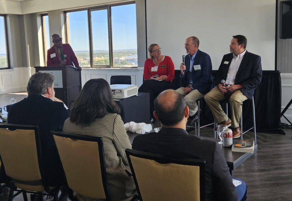
At the Urban Land Institute (ULI) Savannah’s The Science of Sea Level Rise panel last month, experts from research, engineering, and planning came together to discuss what it means to translate data into action. The message was clear: adaptation is not optional. It’s the new foundation of resilience
Science with a Local Tide Gauge
“Here in the Georgia coast, we have a higher rate of sea-level rise than the global or even the national average,” said Jill Gambill, Executive Director of the Coastal Equity and Resilience (CEAR) Hub at Georgia Tech. “That’s partly due to land subsidence, but also how ocean circulation pushes water toward our coast.”
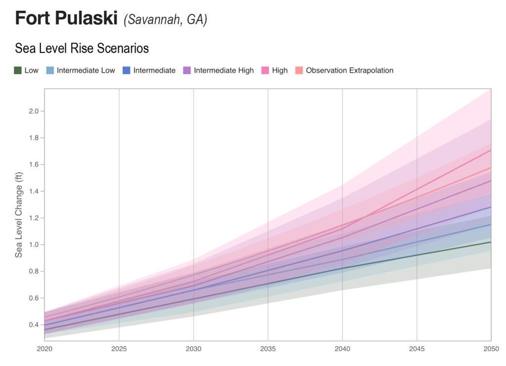
Since 1935, Savannah’s Fort Pulaski tide gauge has been recording sea levels every six minutes. Over that time, the city has seen an average annual rise of 3.66 millimeters, roughly three stacked credit cards per year. But in recent decades, that rate has accelerated dramatically. Since 2000, sea levels have risen 6.5 inches, and projections show another 13 inches by 2050.
Those numbers may sound small, but their impact is anything but. Flooding days are increasing, marshes are changing shape, and infrastructure—from drainage to housing—is under new pressure. “We’re not just talking about the coast,” Gambill added. “Rising sea levels are also an inland issue. Everything is connected.”
Adapting by Design
For Kevin Smith, Principal and Project Manager at Thomas & Hutton, the challenge isn’t just understanding science, it’s engineering for it.
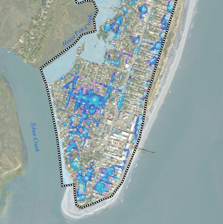
“Our work on Tybee Island’s Stormwater Master Plan is all about adapting to what’s in front of us,” Smith explained. “We know we can’t solve every problem, but we can plan smarter for what’s coming.”
The plan integrates sea-level projections into drainage modeling, cost-benefit analysis, and adaptive design. Backflow prevention, living shorelines, and elevated pathways are part of a layered strategy to keep floodwater out while preserving marshes’ natural storm-buffering role.
“Economic prosperity today may not lead to economic prosperity in 20 years if we don’t design for what’s coming,” Smith said. “Whatever money we save today, we’ll spend later in damages.”
As he put it, designing for sea-level rise isn’t about “if”—it’s about how responsibly communities can adapt. For Thomas & Hutton, that means factoring sea-level scenarios into every stormwater and wastewater model and discussing long-term risk openly with clients. “Our first duty as engineers is to protect public health, safety, and welfare,” Smith added. “That includes what happens when the tide comes in.”
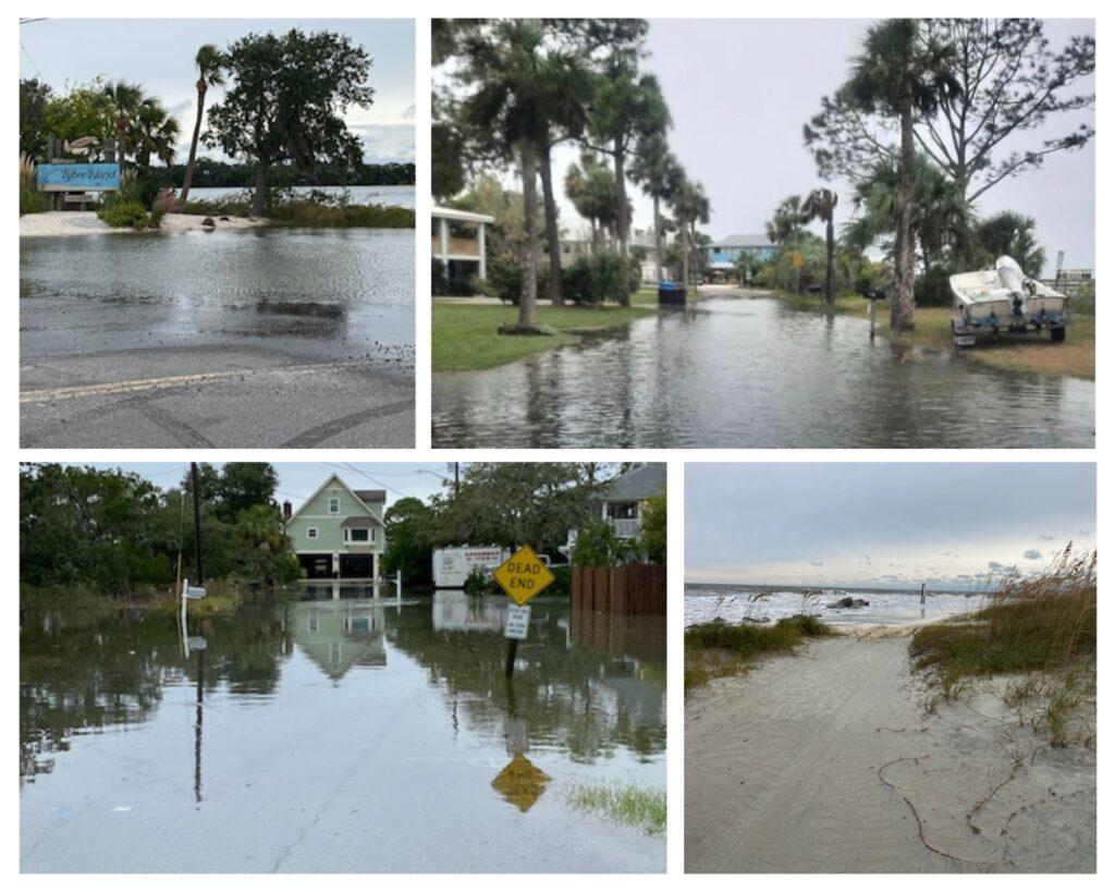
Existing rainfall flooding on Tybee Island
Policy, Planning, and the Long Game
While science and engineering are advancing, policy must catch up. Alan Robertson, Principal of AWR Strategic Consulting and a longtime advisor to coastal communities, emphasized that resilience is as much about governance as design.
“Everything is connected, and that means no community can do this alone,” Robertson said. “To get big funding, you need big impact, which requires regional collaboration. And that takes vision that extends beyond a single election cycle.”
Robertson noted that neighboring states like South Carolina and Virginia have created dedicated offices of resilience, helping coordinate resources and research. Georgia, he suggested, would benefit from a similar approach.
He also cautioned against complacency. “We used to think we were a hurricane-protected coast,” he said. “Then came Matthew and Irma. The storms didn’t hit us directly, but the impacts did. Those moments remind us, ‘build back better’ doesn’t mean build the same thing in the same place. It means build back different.”
People at the Center
The science of sea-level rise is often told in inches and millimeters, but its human impacts are measured in flooded homes, health risks, and lost opportunity.
Gambill pointed to social dimensions that often go overlooked. “We model where the water will go, but not how it will affect people’s lives,” she said. Flooding worsens mold exposure, disrupts work and school access, and deepens housing inequities. For families with heirs’ property, where land is shared across generations, obtaining insurance or disaster relief can be nearly impossible. “We need to ask who will be protected and who will be left behind.”
Collaboration as the New Currency
Resilience is no longer just a local issue. It’s regional, systemic, and deeply human. As the panelists agreed, the solution will come from the intersection of science, planning, and engineering, not from any single discipline.
Water, after all, “always finds its weak spot.” The goal is for communities to find, and fix, their vulnerabilities before the next storm does.
Because when science meets strategy, sea-level rise stops being an abstract threat and starts becoming a solvable challenge.
At Thomas & Hutton, we’re helping communities plan, design, and adapt for a changing coast. Learn more about our water resources and resilience solutions.